


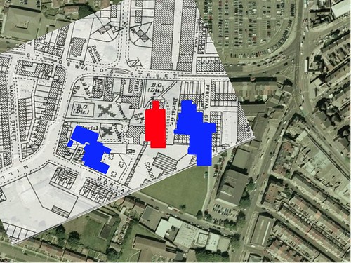
The enclosed picture is an old ordnance survey map (year unknown) Which clearly shows a burial ground in the area concerned. In fact it shows two burial grounds (disused) alongside each other, (I have marked these with a cross). The grave yard of St Oswalds is also shown.
In the book 'The Iron Church' a history of St Georges church, there is an item related to the Irish immigrants and the city council having to hire thousands of special policemen and the government sending 2;000 troops to Liverpool.
Make of this what you will!

 Reply With Quote


Bookmarks