
1873 map.
Source: LRO.

1873 map.
Source: LRO.

Hi Xkopite,
I put this in the Liverpool Past>Housing>Ashfield Cottages thread but have just come across your post here, maybe you can help.
When my Granny married in 1887 she was living in Carey St. This was next to Abstinence St. in the area renowned for the poor quality of its health, sanitation and life expectancy. These streets were so bad they were wiped out sometime before 1906 [O.S. map 1906]. They are shown on my "alleged" map of c.1890.
They are shown more clearly on an 1891 map found at toxteth.net [can't do links!!?].
http://www.toxteth.net/places/liverp...e%20street.htm
[Maybe I can?!?]
Does anyone have a copy from which they can show me a larger area?
Joge
Originally Posted by joge

Large scale map at Liverpool Record Office
1890 OS map from LRO.
Sorry, it's rather murky.
BTW. This is the second time you refer to your "alleged" map of 1890.
All I said was, it isn't the 1890 OS version (as they show individual buildings as you can see on this one you've requested).
Yours might well be 1890, but I don't think I've seen it before.
http://www.yoliverpool.com/forum/att...2&d=1180736419
Thanks Phil, no offense please. I just wasn't sure about the provenance of the map, the only info given is c.1890, so I guess S&n Genealogy Supplies aren't too sure about the date either. In future I'll refer to it as my 1890 map.
Thanks again for your latest posting.
Are we O.K.??
Joge
Yes, we're fine.
I wish I could say what map yours is, because I've seen most of them.
Fascinating to see the density of housing when you compare it to what is there now.
This is what the cover and the map look like, if it's any help.
The cover says it all.
It was published by Bacon and based on the OS, which most maps are.
The OS covered Liverpool from the 1840s.
I don't think the Record Office have this particular map.
Would you scan the Dingle area for me, and I might be able to date it reasonably accurately?
Thanks.
How's this?
Fine, thanks
It's nearer 1880 than 1890.
I'll check dates of various buildings later and get back to you.
I have a later version of yours (sixth edition) and using a little detective work, mine was issued in 1966, see scan.
yours being the third edition i would say came out in the 30's, as they probably came out every 10 years.
Hi Joge.
I've come to the conclusion that Bacon's used a map, perhaps from the early 1870s (no later), and haven't attempted to do much of an update.
The school in Park Hill Road is shown, but I never managed to find out when it was opened, but thought 1880s.
The following empty sites on the map would later contain the following buildings.
Mount Carmel Church and St Peter's Church, High Park Street (both 1878).
Beaufort Street School (1875).
St Gabriel's Church (1884).
However St Silas Church, High Park Street is also an empty site and that was built in 1865, but St Cleopas Church is shown (built 1867).
So I gave up then!
Hi Phil,
Impressive research!!!
Maybe you can shed some light on this, though I'm not sure this is the right thread to broach it.
When I was growing up in L,pool my family often referred to Carey St., in various ways, as a euphemism for extreme poverty. I assumed it was a widely held saying, but, Googling it, and down South here, no-one else seems to have heard it used that way. Is it a L,pool thing, or was it just confined to my family — a tradition founded in my Granny's early experiences having lived for some time in Carey St.?
 Posting Permissions

 Reply With Quote
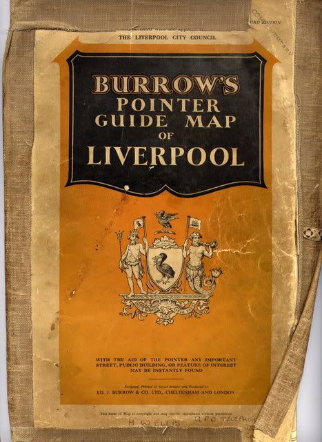


Bookmarks