
I think Harford Lane must have been inbetween Brownlow Hill and Mount Pleasant, Bartlam St must be nearby.


I think Harford Lane must have been inbetween Brownlow Hill and Mount Pleasant, Bartlam St must be nearby.
Both Bartlam st & Harford Lane are on this map:
http://www.toxteth.net/maps/liverpool/lpool21b.htm
Thank You once again
Browniescorner
out of my mind.....back in 5 minutes.....
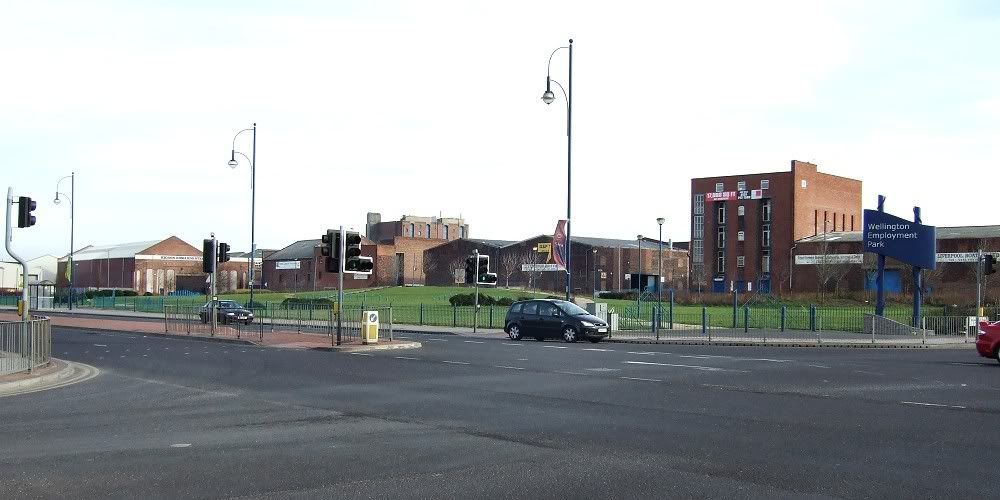
This is the grassy area between Great Howard Street and Boundary Street. Townsend Street is just to the left of the tall warehouse (on the right of the picture). Some of these warehouses look late 1800s to me and Townsend Street still has its' old metal street-sign.
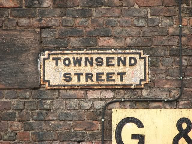
Thanks so much. The pic, it's great. You said that Townsend st still has the old sign, could I ask you, Please, please, please to get a photo for me.
Browniescorner
out of my mind.....back in 5 minutes.....
I'll get a pic this week-end, unless someone beats me to it.
Townsend Street. The weather was rubbish for any decent pics, but here's the sign. This was one of the very few old ones I noticed around here.
Hiya Marky, I got down there too.
This pic is of the Liverpool Boat Co and the street sign on the wall. Looking East up the street.
The street sign a bit closer but not as close as Marky's.
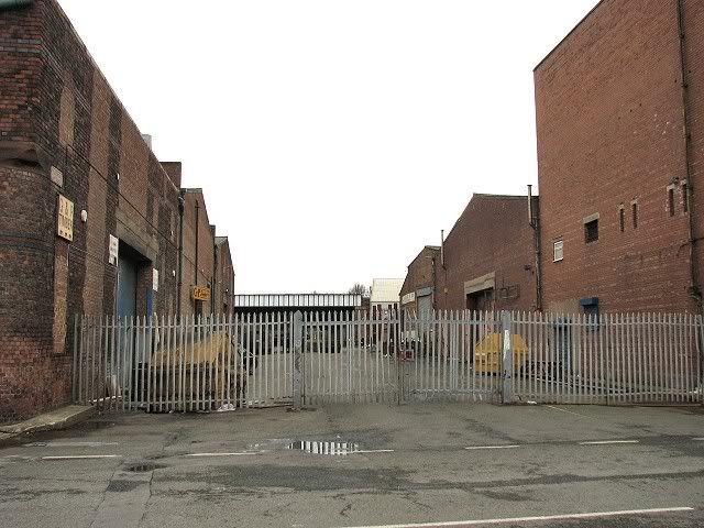
The opposite (south-east) corner of the street. No street sign here though.
Looking up the street and capturing a train crossing the old Exchange line (now the underground loop) to the North.
Looking North along Boundary Street across Townsend Street.
Looking North West from Townsend Street towards the Docks.

Last edited by Ged; 02-25-2008 at 10:46 AM.
Wow! Thank You Ged & Marky. Great shots!
Browniescorner
out of my mind.....back in 5 minutes.....
 Posting Permissions

 Reply With Quote


Bookmarks