
Originally Posted by
marky

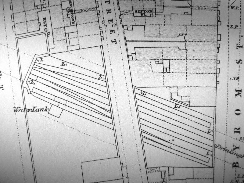
The article was from the Liverpool Mercury Sept. 2nd 1867. The nearest dated map I have is the 1864 Liverpool (Vauxhall) Reprint c)Alan Godfrey edition. Surveyed in 1848 and updated in 1864 to include new railways. The original large scale map may show more detail of the area, just 1 year before the line opened.
I presume the labels 'L' are lamps. There must be a reason for having a row down one side of the cutting. A Water Tank is shown very close to the cutting, any reason?
Excellent find Marky. The two sidings are also shown on the 1890 edition 1/500 map held in Liverpool Record Office but by then the watertank appears to have gone. The L's do indeed denote lamps.
The interesting thing to note are the line from the watertank and the rectangle in the track. Could denote a water crane and pit??
Regards
Mike


 Reply With Quote


Bookmarks