
Thanks Zappa

Thanks Zappa
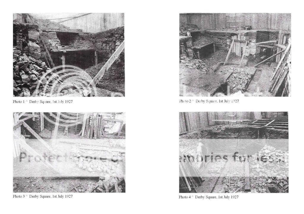
These are the prepatory excavations for public conveniences about the Queen Victoria Memorial.
Photo 1 ^ excavations for public conveniences, Derby Square, 1st July 1927
Photo 2 ^ excavations for public conveniences, Derby Square, 1st July 1927
Photo 3 ^ excavations for public conveniences, Derby Square, 1st July 1927
Photo 4 ^ excavations for public conveniences, Derby Square, 1st July 1927
All photographs courtesy of LRO.

Amazing stuff dazza, appreciate the time you've put into this and I find it all fascinating.
Anybody know when the toilets in Derby Square were finally closed?? I'm probably wrong but I'm sure I remember them being there early 80s??
Thanks gynsman, I'm glad you find it interesting. The LRO had incorrectly entitled this series "Castle Moat". I'll explain why this isn't exactly right tomorrow. A bit more digging to do in the meanwhile.

Double post, sorry")
just to add to the story, i worked as a telegram boy at derby house 1968/69, sefton house is the other building, some of the lads who had been there a long time knew how to get across the city centre from derby house underground when it was raining, i remember we were given luncheon vouchers and there was a great civil service canteen in whitechapel who accepted them, one day we agreed to go there for lunch but the heavens opened, one of the older boys took us almost all the way there underground, going through mostly boiler rooms and some tunnels, was well impressed
another bit of fun was we would go the the bernie inn in the bottom of sefton house underground so our boss would not see us, all under 18, we could get into the bernie inn and sit in one of the bars in the dark waiting for a waitress to open up and turn the lights on, used to frighten the life out of her but she got used to us
Originally Posted by dazza

. It never has in the past Dazza
Thanks for that confirmation,Bidston!I wonder if you can still do it now?
Fantastic as usual Dazza. Well done.
All the photographs were taken on 1st July 1927. Scroll up to Post#32 for the larger versions of each image.
The LRO had mistakeningly titled this series "Old Castle Moat, During Excavations For Public Conveniences". They were only partially right, as the next few images will explain.
The excavations shown in the photographs ^ were dug in preparation for the Ladies convenience, Derby Square.
--------------
The illustration below shows the position of St George's church in relation to the excavation site. ie: an OS map 1927 [same date as the photos] is laid over an earlier 1848 OS map, which shows St George's church.
The walls that you can see in the photographs are John Foster Junior's reconstruction of St Georges church tower/ spire 1818-1825; the previous spire had to be dismantled by his father, due to subsidence caused by settlement of the castle moat, which the tower is built over. I've highlighted [in orange] the remainer of the church walls seen in the photographs. You are basically looking at the space between the body of the church, and the well created for the crypt and basement. This, the LRO mistakingly thought was the castle moat. They were partially right, as we are looking inside of the church crypt, which sat within the moat.

You have done a fantastic job there Dazza. How do you get so much information
Thanks fortinian and suzi. I guess I can't stop digging?
Dazza.
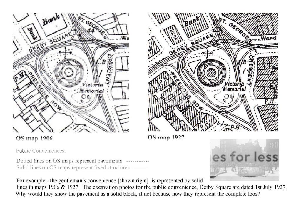
What you describe as the Ladies' Toilet on the 1927 Edition OS map (revised in 1924) is also shown on the 1906 revised OS map.
I still think both toilets were built at the same time as the Memorial.
Obviously, I'm not discounting the fact that further work never occurred.
QS, I'll try and answer your question here.
Firstly, I don't need the OS maps to verify the position or date of the public convenience at Derby Square - the LRO excavation photographs are entitled "Old Castle Moat, During Excavations for Public Conveniences, Derby Square" and are dated 01/07/1927. SOURCE: here.
I've put the two maps you describe below. As I've said on the [oversized!] text below. The dotted lines are for paving, and solid lines represent fixed structures. The excavation photos show Preeson's Row over the fence in one frame, and the Queen Victoria memorial in an other - these reference points tie them to the triangle of paving NW of the memorial on the 1906 map.
The engineer's simply excavated the only piece of land available to them at that time, which they've later recorded as a solid line - on the 1927 map. OS map amendments carried forward right up to the edition issue, and were NOT limited to particular revisions that were noted. The same also applies to drawings.
"I still think both toilets were built at the same time as the Memorial......Obviously, I'm not discounting the fact that further work never occurred" Your sources please?
Nice one Dazza, yer well into it. I have an old L/pool map in an old book....Ask Gnasher if it will be any good to you as he's studied it. If it is yer welcome to take it to study too.
Keeping it real!
LIVERPOOL OLD POSTCARDS AND PHOTOS HERE http://s197.photobucket.com/albums/a...To%20Download/
http://www.youtube.com/watch?v=kKmGi...eature=related
http://www.thebreastcancersite.com/
 Posting Permissions

 Reply With Quote


Bookmarks