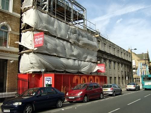
Durning Rd, Edge Hill as promised


Durning Rd, Edge Hill as promised
Proud Scouser, with a dabbling of Welsh and Irish.
bore yourself silly at my Flickr page...anorak central!
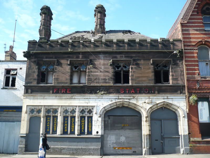
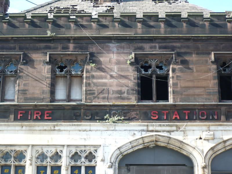
Former Police HQ, Hope Street.
May 2007
http://www.flickr.com/photos/2563250...0721/?edited=1
The work that's gone into that building.And the crap that's built today!!Originally Posted by quincyg

Why can't these be saved? Am sure they could be.
True Zaps!!!
Deleted
Last edited by Chris48; 07-14-2008 at 03:50 PM.
Hope St/Hardman St: I don't know when this closed, but it still gets marked as a Police Station on my mid-90s A-Z.
The 'School for the Blind' part is safe enough, but that office-block needed to go.
As far as I know, there is still an ex-Police Station in Aigburth Vale. I'll have to check though, as the buildings here were rennovated/painted white last year. I think it's the first tall, white, building as you come down from the corner with Elmswood Road.
It's identified on the 1908 OS map.
There's a Methodist Chapel on the corner, then a semi-detached building, and the police station is either the second half of that, or a little building to the right.
ie The third or fourth address on that side of Aigburth Vale.
The 1924 OS map identifies the chapel, but not the police station and by the time of the 1936 Kelly's directory, neither the chapel nor the police station is listed.
Has anyone posted a pic of 'Cuffs' in Wavertree yet (in its new colour)?
Become A Supporter 👇
Donate Via PayPal

I went past that on Tuesday but didn't do a photo as there was already one posted up. I'm hoping to get to Wavertree Park today to look for summat so if I get a different bus from here I can do Cuffs on the way.
Proud Scouser, with a dabbling of Welsh and Irish.
bore yourself silly at my Flickr page...anorak central!
Cuffs, Wavertree. Up until a year or two ago, this was still unpainted natural stone. Then the owners ruined it.
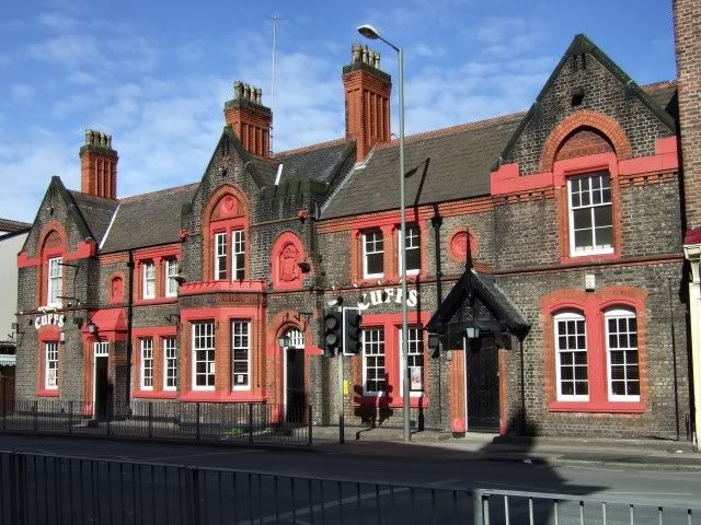
the red looks awful doesn't it.
thanks for posting that up, saves me a detour
Proud Scouser, with a dabbling of Welsh and Irish.
bore yourself silly at my Flickr page...anorak central!
will try and get a pc this weekend!
Hasn't it had another colour on the brickwork since that pic?
Become A Supporter 👇
Donate Via PayPal
Allerton Road police station 1930 - LRO
Tuebrook police station being demolished in 1967 for dual carriageway. The new station was built to the rear of this on Orphan Drive. Pic by Harry Ainscough - LRO
.
Re: Cuffs, Wavertree: I only took that pic this week. It was painted cream before that (and natural stone before that).
Re: Aigburth Vale: Nowadays there is a small half-building inbetween the two buildings under consideration as the Police Station. This small building appears to fill a gap shown on the 1908 map. The map writes Police Station across the two properties. Garstonians may be interested in this one, as it is right on the Toxteth Park/Garston Township boundary.
 Posting Permissions


 Reply With Quote


Bookmarks