Page 9 of 14 FirstFirst ... 7891011 ... LastLast
Results 121 to 135 of 203

Thread: Everton District

  1. #121
    Roving Arriva Bus User! wallasey's Avatar
    Join Date
    Jul 2006
    Location
    Wallasey
    Age
    35
    Posts
    425

    Default

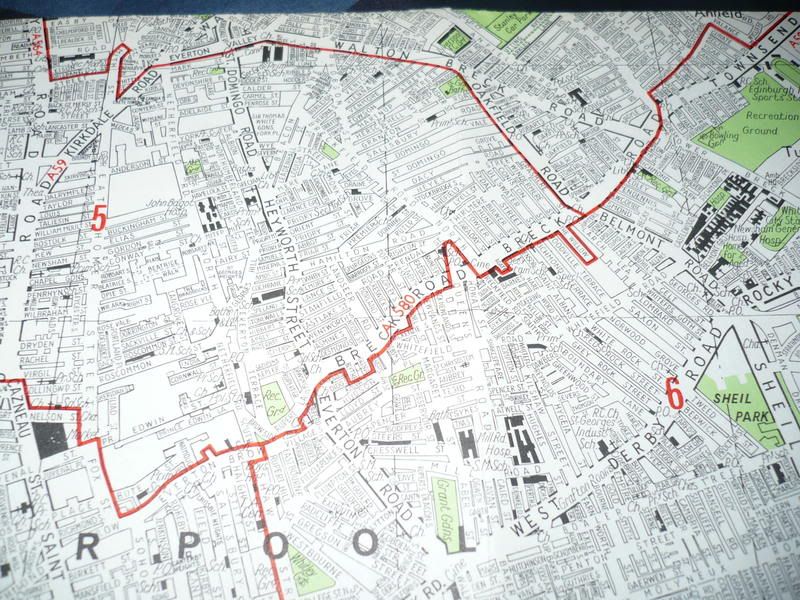
    I've got an interesting....and quite possibly a controversial question to ask....What are the boundaries of Everton?


    The reason why I ask is because I've been around Robson Street/Mere Lane today (taking piccies as you do) but I dont know weather I should upload em' to Anfield (as Breckfield Road is normally considered to be a part of Anfield me thinks) or Everton.

    Many Thanks in advance!
    Liverpool Suburbia@Flickr

    UPDATED 14JUN09 20 images added to Dovecot
    Last updated 26ARP09 (Aigburth)
    Apologies for the durge in updates!

  2. #122
    Re-member Ged's Avatar
    Join Date
    Dec 2006
    Location
    Here, there & everywhere.
    Posts
    7,197

    Default

    Very borderline that but Everton library is of course at the top of Mere Lane, Sir Thomas White Gardens that were on the south side of Penrose Street were Everton L5 but imho i'd say Robson street and anything East of it is then Anfield.
    www.inacityliving.piczo.com/

    Updated weekly with old and new pics.

  3. #123
    Roving Arriva Bus User! wallasey's Avatar
    Join Date
    Jul 2006
    Location
    Wallasey
    Age
    35
    Posts
    425

    Default

    Thanks Ged...so is Breck Road between Sheil Road and Heyworth Street in Everton? I always thought it was, but as it is running down the other side of the hill, it is perfectly feasible to say that all of Breck Road is in Anfield.

    But where exactly is Everton??? Some would say Great Homer Street is under Everton's belt...but others would suggest that its in Vauxhall. It's hard to distinguish where districts merge sometimes. We all know where Walton is...and we all know where Old Swan is....but what about Everton?

    I do hope the above question doesn't sound somewhat shocking to you!!!
    Liverpool Suburbia@Flickr

    UPDATED 14JUN09 20 images added to Dovecot
    Last updated 26ARP09 (Aigburth)
    Apologies for the durge in updates!

  4. #124
    chippie
    Guest chippie's Avatar

    Default

    Hiya Russ,

    I always thought that Breck Road started at Lower Breck Road and Priory Road junction and ended at Everton Road Heyworth Street junction. Well it was when I was growing up there.

    As for the Anfield/Everton districts, doesn,t Everton start from Oakfield Road/Sheil Road?

    If this has already been said, then it just shows that I didn,t follow the thread up to the top.

  5. #125
    chippie
    Guest chippie's Avatar

    Default

    And Everton runs from West Derby Road to the bottom of St Domingo Road where it hits the Everton Valley junction.

  6. #126
    Senior Member lindylou's Avatar
    Join Date
    Sep 2005
    Posts
    3,677

    Default

    Quote Originally Posted by chippie View Post
    Hiya Russ,

    I always thought that Breck Road started at Lower Breck Road and Priory Road junction and ended at Everton Road Heyworth Street junction. Well it was when I was growing up there.

    It does . There is a sign saying Everton up by Belmont rd.

    I think that's where L'pool 5 begins - - looking up towards town direction - - over to the right side of Breck rd (Oakfield side) is L5. but over to the left (Belmont side) is L6. or at least addresses in Belmont rd are L6 .. running towards Sheil?Kensington district which is still L6.


    Although there is a sign for Everton, I don't really think of it as being Everton until you turn the corner into Everton rd or Heyworth st.

    Breck rd, even though it is in 2 halves, most people consider as Anfield. It's a difficult being right on the border.


    just to confuse matters - addresses down from Oakfield rd merge with both L4 & L6 - streets running down towards the direction of Walton Breck, Anfield rd.

  7. #127
    PhilipG
    Guest PhilipG's Avatar

    Default

    I asked in the library if there was a definitive source to establish Liverpool's boundaries, and there isn't, apart from maps, which are quite confusing.
    The problem with boundaries is there are so many different types, you can just choose the one to suit yourself, and your particular viewpoint.
    The only area which has really been established is Toxteth Park, which is an historical area.

  8. #128
    Re-member Ged's Avatar
    Join Date
    Dec 2006
    Location
    Here, there & everywhere.
    Posts
    7,197

    Default

    You mentioned Old Swan there wallasey, you'd be surprised even at that boundary, there was a discussion on here in the past surrounding where is 'Stanley' as in Stanley abbatoir, market, residents association, St. Annes church - Stanley. Many people merge Fairfield straight into Old Swan at L13.

    There's an Everton sign down by toys r us - poppycock.

    I know what you mean though about Gt Homer street confusion about whether it's Vauxhall or Everton, maybe that's the border too?
    www.inacityliving.piczo.com/

    Updated weekly with old and new pics.

  9. #129
    Senior Member lindylou's Avatar
    Join Date
    Sep 2005
    Posts
    3,677

    Default

    Quote Originally Posted by lindylou View Post
    It does . There is a sign saying Everton up by Belmont rd.

    I think that's where L'pool 5 begins - - looking up towards town direction - - over to the right side of Breck rd (Oakfield side) is L5. but over to the left (Belmont side) is L6. or at least addresses in Belmont rd are L6 .. running towards Sheil?Kensington district which is still L6.

    just to confuse matters - addresses down from Oakfield rd merge with both L4 & L6 - streets running down towards the direction of Walton Breck, Anfield rd.

    to reply to my own post ..

    .. I have just been on the bus along Breck rd and I looked at the street signs.

    They are as I have said - all on one side L5, the other L6.

    Strangely enough there is one lone L5 right in the middle of the L6 streets !

    Agate st (by Iceland supermarket) is L5.

    answer that one !!

  10. #130
    tattooed gt-grandma quincyg's Avatar
    Join Date
    Feb 2008
    Location
    Bootle, United Kingdom
    Age
    57
    Posts
    1,030

    Default

    Quote Originally Posted by lindylou View Post
    to reply to my own post ..

    .. I have just been on the bus along Breck rd and I looked at the street signs.

    They are as I have said - all on one side L5, the other L6.

    Strangely enough there is one lone L5 right in the middle of the L6 streets !

    Agate st (by Iceland supermarket) is L5.

    answer that one !!
    The Willow is another one.
    from a late 1960's street map. the red line is the area boundary.
    Agate St is to the right of the pointy bit at the bottom, the Willow is to the right again.
    Proud Scouser, with a dabbling of Welsh and Irish.

    bore yourself silly at my Flickr page...anorak central!

  11. #131
    Senior Member lindylou's Avatar
    Join Date
    Sep 2005
    Posts
    3,677

    Default

    Thanks Quincy.

  12. #132
    tattooed gt-grandma quincyg's Avatar
    Join Date
    Feb 2008
    Location
    Bootle, United Kingdom
    Age
    57
    Posts
    1,030

    Default

    Quote Originally Posted by lindylou View Post
    Thanks Quincy.
    pleasure. some boundary's are even more strange than that one. streets are like fingers creeping into a neighbouring area.
    Proud Scouser, with a dabbling of Welsh and Irish.

    bore yourself silly at my Flickr page...anorak central!

  13. #133
    Senior Member taffy's Avatar
    Join Date
    Dec 2006
    Posts
    1,323

    Default

    Quote Originally Posted by quincyg View Post
    pleasure. some boundary's are even more strange than that one. streets are like fingers creeping into a neighbouring area.
    I prefer to use historical boundaries. Post code boundaries are simply for the convenience of Royal Mail and don't reflect historical boundaries though clearly there is some overlap. Everton was one of the historical townships surrounding Liverpool. It had defined boundaries which were usually originally field boundaries. Of course all this was lost when Everton was absorbed into Liverpool in the mid 1830s.

  14. #134
    Senior Member taffy's Avatar
    Join Date
    Dec 2006
    Posts
    1,323

    Default Boundaries of Everton

    I've had a look at Davies's 1855 map of Liverpool which clearly shows the township boundaries of Everton. Essentially starting at Gt Homer St ( which was once called Boundary Lane) follow a line up opposite Boundary Street to Netherfield rd, then along Everton valley to Anfield Road cutting back to Walton Breck rd along Rockfield Rd, then along walton Breck Rd etc to Whitefield Rd. Along Whitefield rd to surprise, surprise Boundary Lane to West Derby Rd. Along West Derby Rd to Shaw Street, down Canterbury St, turn left at william Henry St and then right along Fox St and back to Gt Homer St.

    This is approximately the old boundaries of Everton. There was some rounding off of field boundaries when streets such as Gt Homer St were laid out.

    Hope this helps

  15. #135
    Re-member Ged's Avatar
    Join Date
    Dec 2006
    Location
    Here, there & everywhere.
    Posts
    7,197

    Default

    Interesting Taffy. What area is given to what it now known as Vauxhall please?
    www.inacityliving.piczo.com/

    Updated weekly with old and new pics.

Page 9 of 14 FirstFirst ... 7891011 ... LastLast

Similar Threads

  1. Walton District
    By Kev in forum Liverpool's North East Edge
    Replies: 96
    Last Post: 01-28-2011, 03:03 PM
  2. Everton District
    By wyestreet in forum Architecture in Liverpool Suburbs
    Replies: 2
    Last Post: 05-09-2007, 09:56 PM
  3. Is your district going like this ?
    By steveb in forum Liverpool District Chat
    Replies: 6
    Last Post: 03-01-2007, 11:15 PM

Tags for this Thread

Bookmarks

Posting Permissions

  • You may not post new threads
  • You may not post replies
  • You may not post attachments
  • You may not edit your posts
  •