
for your own private recital perhaps?Originally Posted by knowhowe


for your own private recital perhaps?
As a clued up south-ender I knew exactly what O'Connors Tavern was about.
Great pub!
The new Amsterdam at Liverpool?
Save Liverpool Docks and Waterways - Click
Deprived of its unique dockland waters Liverpool
becomes a Venice without canals, just another city, no
longer of special interest to anyone, least of all the
tourist. Would we visit a modernised Venice of filled in
canals to view its modern museum describing
how it once was?
Giving Liverpool a full Metro - CLICK
Rapid-transit rail: Everton, Liverpool & Arena - CLICK
Save Royal Iris - Sign Petition

That definitely was performance poetry. . .
Christopher T. George
Editor, Ripperologist
Editor, Loch Raven Review
http://christophertgeorge.blogspot.com/
Chris on Flickr and on MySpace
Hi guys, and Happy New Year 2010!
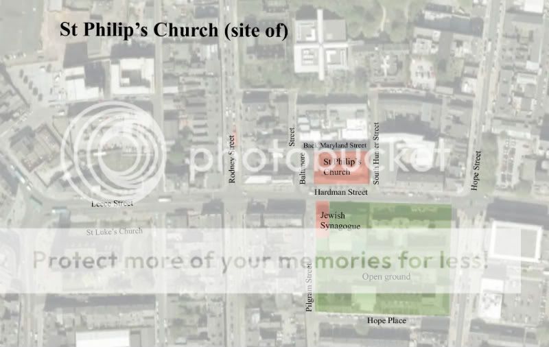
A few updates on the site of St Phillip's Church, Hardman Street.
St. Philip's Church was not on the site of the Fly in the Loaf pub, as we originally thought. It was on the land next to it, now occupied by the Victorian red bricked building leading up to South Hunter Street. Hopefully this should clear it up a little?
Image 1 ^ Google earth view, with St Phillip's high-lighted.
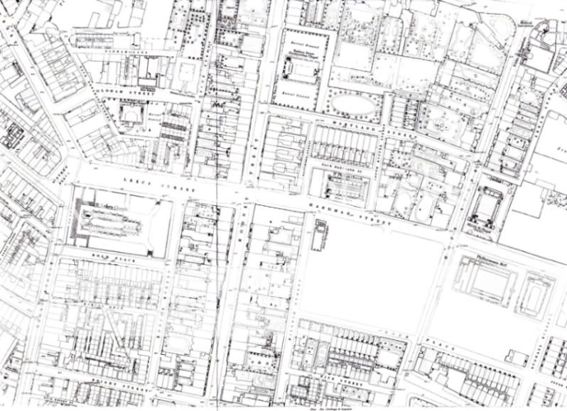
Image 2 ^ 1848 OS map extract of Hardman Street
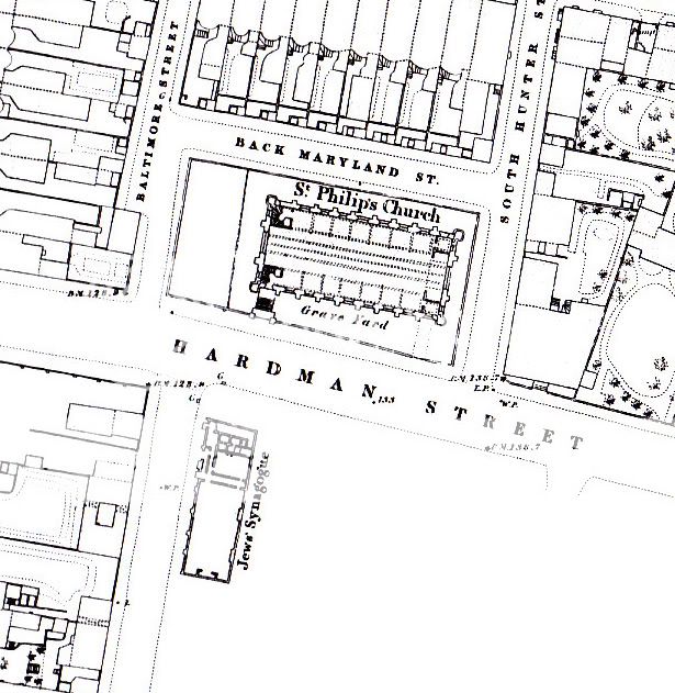
Image 3 ^ 1848 OS map large scale
Image 4 ^ St Phillip's Church, Hardman Street
The map above [image 3] confirms that this is the correct image for St Philip's [the original image was unsourced] ie: 8No. buttress walls along the nave, and 2No. at the ends. Also the entrance is in the right place, and the plan is consistant with a tower/ spire-less church.
The image also shows the corner wall edge of what might be the Fly in the Loaf building? It has the same masonry keying as the photographs, although the window's do not correspond....and the lower glazing of the current building is not shown. All of which may have been added/ altered afterwards?
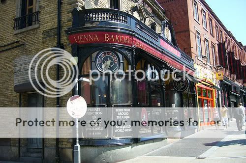
Image 5 ^ Fly in the Loaf, Hardman Street
Image 6 ^ Fly in the Loaf, Hardman Street
In image 4 the building being constructed [demolished?] is possibly the current Fly in the Loaf building? It looks like it's sitting further back from the road than the church gates? I assume that when the church was demolished, the developers had built right up to the edge of where the churchyard wall and gates where? And then following on - the ground floor bay windows to the Fly in the Loaf were added later to meet the new neighboring building, and new street line?
The red bricked building shown above is on the site of St Philip's Church.
D.
I think you're right about the masonry quoining in number 4 corresponding with the fly in the loaf. Any idea at all when number 4 was drawn?
that St Philip's church looks to have been slap bang on the site of an old haunt of mine, Stella Maris's 'Atlantic House' last known to be used as student accomodation for John Moores.
No sorry, I've been trying to fix the date myself but without success. It lies somewhere between 1816-1882 [life of the church].
Image originally posted here
 Posting Permissions

 Reply With Quote


Bookmarks